Research seminar on urban sustainability and resilience
Presented a remote sensing and AI framework for climate, carbon, and green-infrastructure analysis.
Pusan National University · SURF LAB
SURF Lab develops satellite-based urban intelligence for climate resilience, carbon mitigation, and smart-city decision-making.
About SURF Lab
SURF Lab, the Smart Urban Remote Sensing Futures Lab, studies how cities grow, heat, emit carbon, and adapt. Our work combines satellite remote sensing, geospatial artificial intelligence, urban climatology, and smart-city analytics.
The lab focuses on building decision-ready urban datasets and models that help planners, scientists, and communities understand spatial inequalities in heat exposure, urban form, industrial land expansion, and green-infrastructure cooling potential.
What we build
Our workflow links remote sensing and GeoAI with city-scale products and sustainability assessment.
Satellite imagery, land surface temperature, nighttime lights, building data, mobile-network data, and urban sensors.
Local climate zones, land-cover maps, industrial-land datasets, thermal-stress surfaces, and cooling-potential layers.
Urban climate resilience, carbon-emission implications, exposure inequalities, and targeted cooling strategies.
Research themes
 01
01
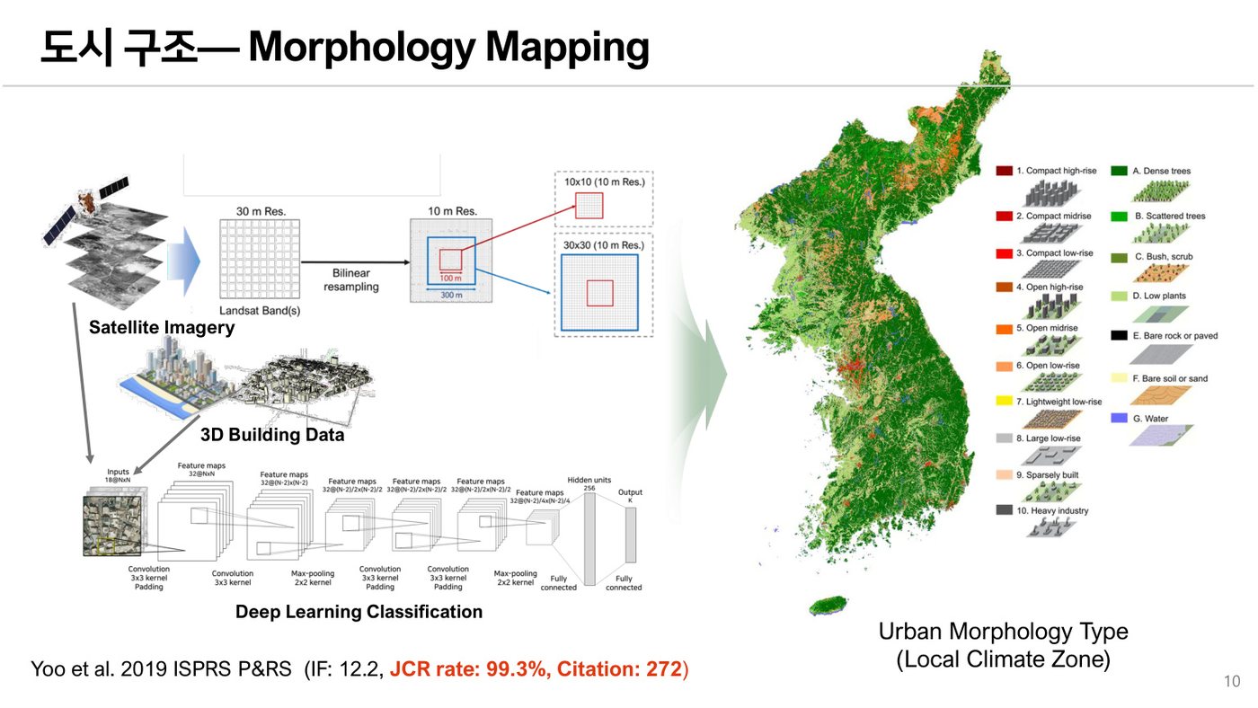
Mapping local climate zones and urban form using satellite imagery, building data, and deep learning.
 02
02
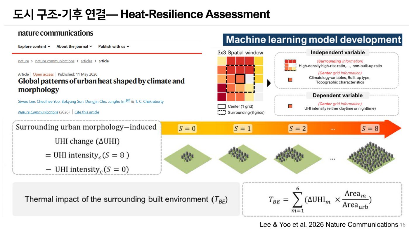
Connecting urban morphology, land surface temperature, and population exposure to quantify heat risk.
 03
03
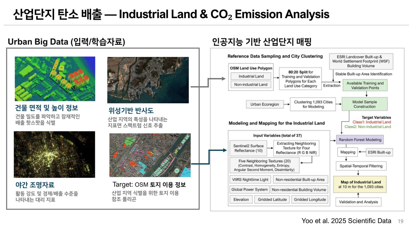
Monitoring industrial land expansion and its relationship with economic growth and carbon emissions.
 04
04
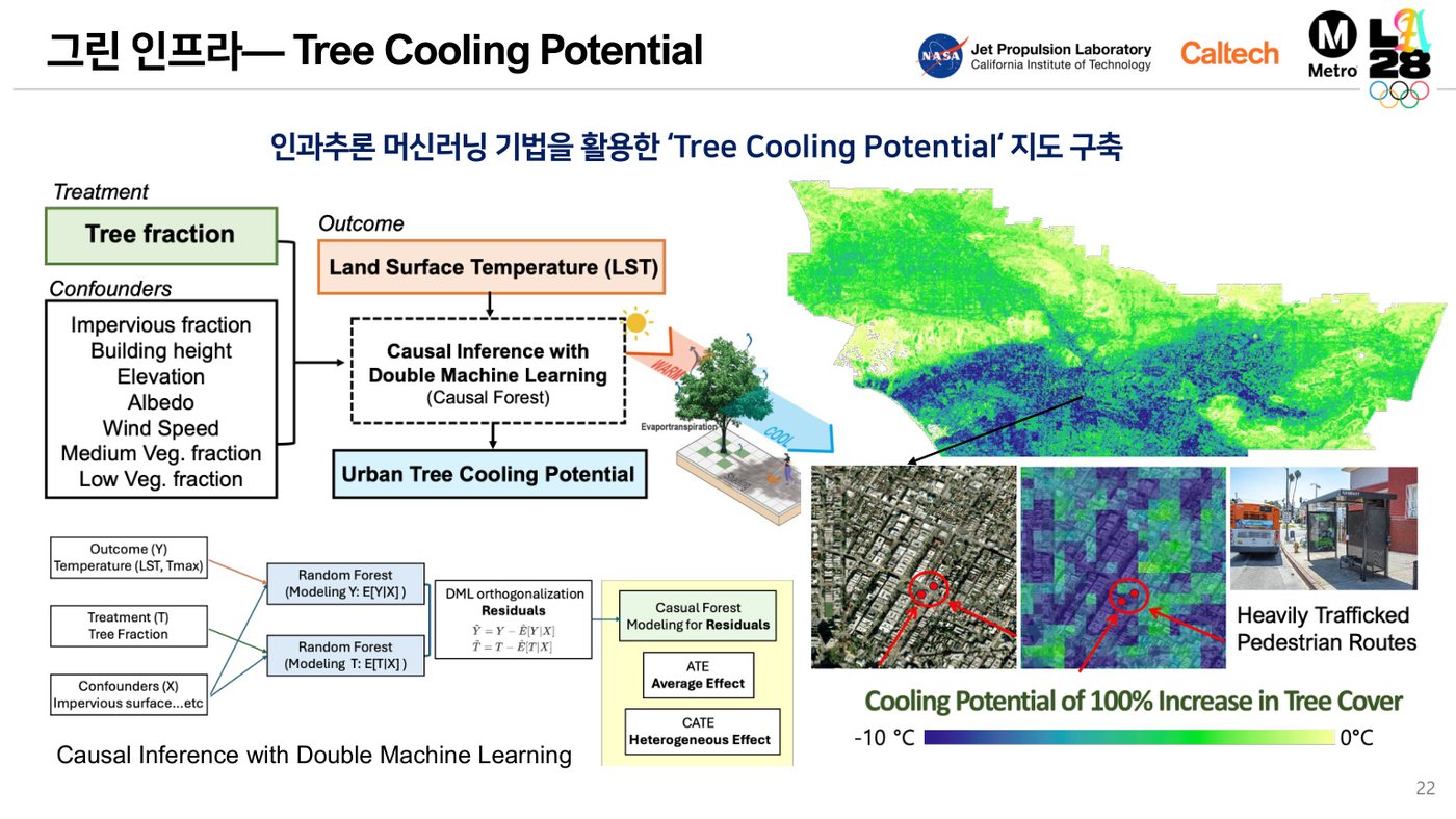
Identifying where green infrastructure can most effectively reduce urban heat exposure.
Latest
Presented a remote sensing and AI framework for climate, carbon, and green-infrastructure analysis.
New work examines how climate and urban morphology shape global patterns of urban heat.
Published a global urban industrial-land dataset for 2017–2023 in Scientific Data.