Research

Remote sensing and GeoAI for sustainable, resilient cities

We build urban datasets, models, and assessment frameworks that connect Earth observation with climate resilience and carbon-aware planning.

Integrated framework

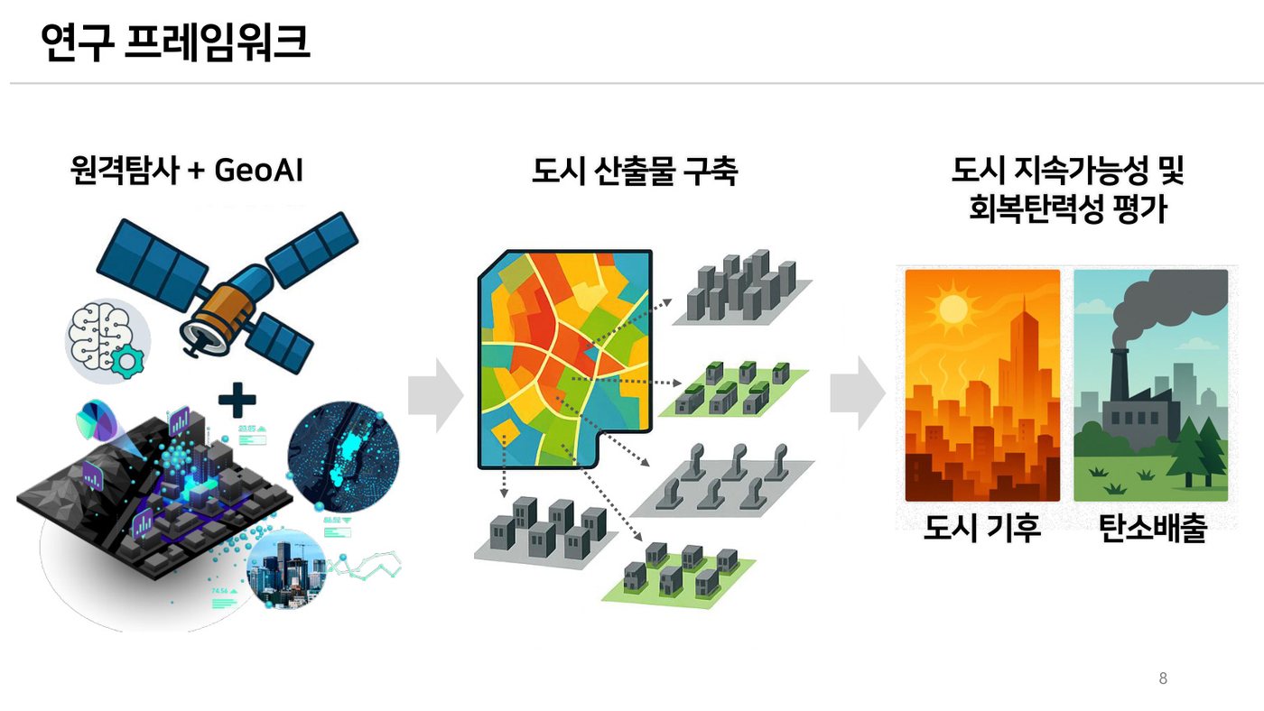
Remote sensing + GeoAI → urban products → assessment

The lab integrates long-term satellite observations, ground sensors, GIS layers, and machine learning to map urban structure, climate, and environmental stress.

Research framework: remote sensing and GeoAI to urban products and sustainability assessment
Framework adapted from the 2026 urban sustainability and resilience seminar.

Data foundation

Urban big data for spatially explicit decisions

Satellite reflectanceLandsat, Sentinel, high-resolution optical data
Thermal observationsLand surface temperature, ECOSTRESS, VIIRS, MODIS
Nighttime lightsHuman activity, economic intensity, energy-use proxies
Urban sensingGround stations, mobile signals, population, IoT and GIS layers
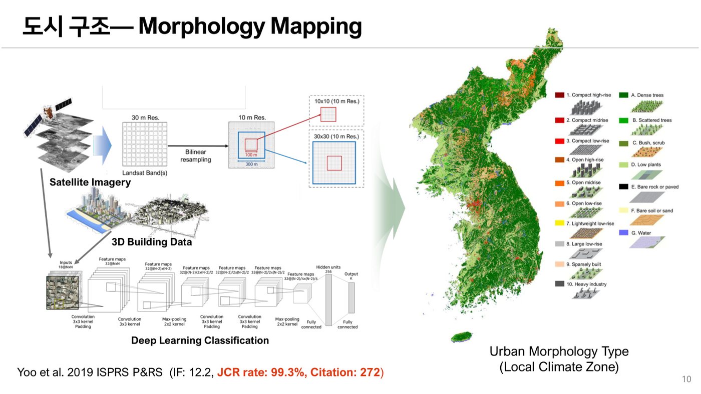
Urban morphology mapping example
01

Urban Morphology Mapping

We map local climate zones and urban morphology types by combining satellite imagery, 3D building data, and deep-learning classifiers. These products support urban-growth monitoring, planning analysis, energy-use modeling, and urban-climate studies.

  • Local Climate Zone mapping
  • High-resolution urban land-cover classification
  • 2D/3D urban-growth analysis
Heat-resilience assessment example
02

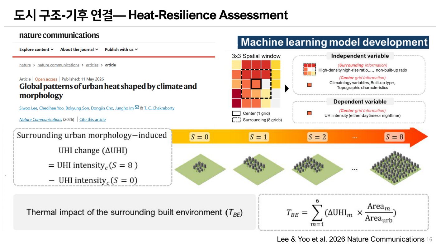
Heat-Resilience Assessment

We assess how urban form and background climate jointly shape surface urban heat and thermal risk. The research links local climate zones, land surface temperature, and dynamic population exposure to inform cooling strategies.

  • Urban heat island and land surface temperature modeling
  • Diurnal heat-risk mapping
  • Climate-morphology interaction analysis
Industrial land and carbon emission analysis example
03

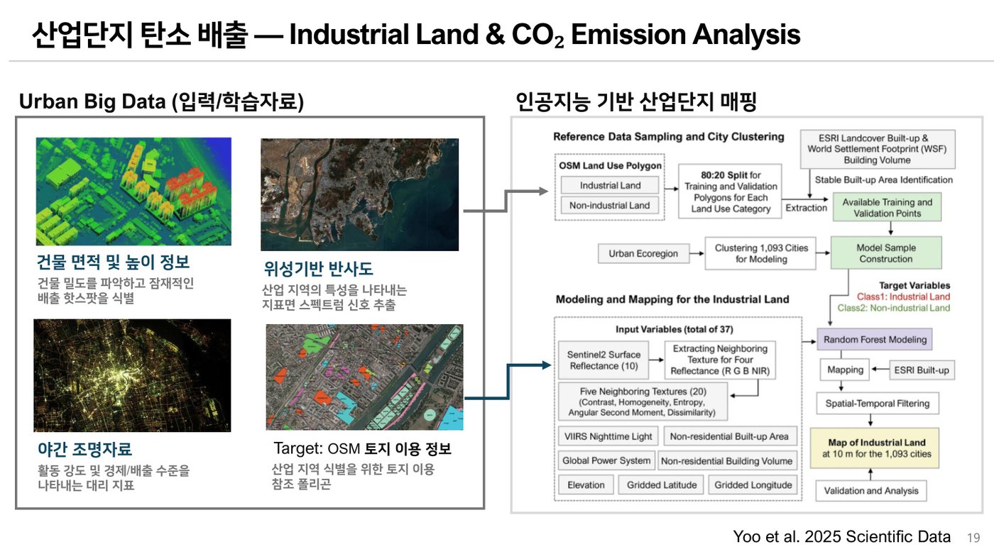
Industrial Land & CO₂ Emission Analysis

We identify industrial land at high spatial resolution and analyze its association with economic growth and carbon dioxide emissions. This work supports global monitoring of industrial urbanization and environmental tradeoffs.

  • 10-m industrial-land mapping
  • Nighttime-light and urban-form indicators
  • Growth-carbon inequality assessment
Tree cooling potential example
04

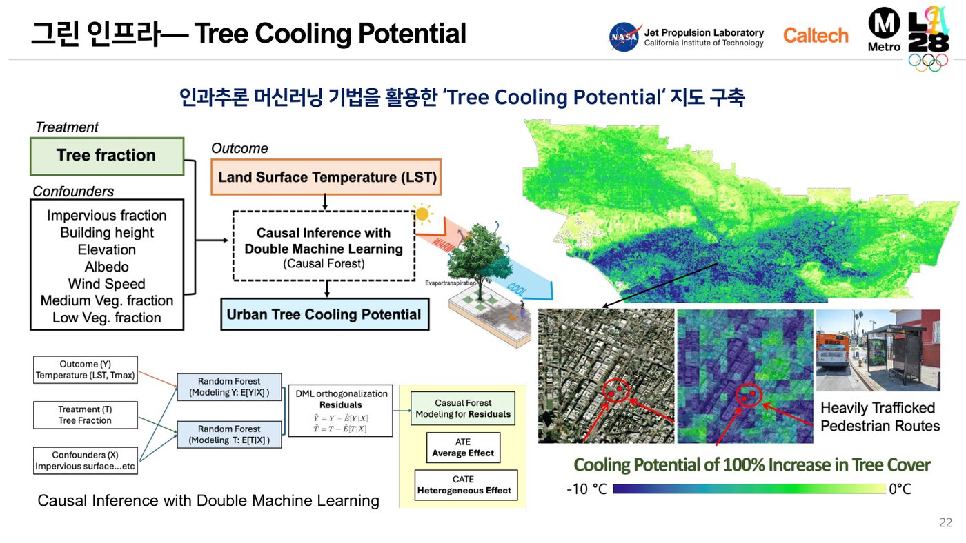
Tree Cooling Potential

We estimate where additional tree cover and green infrastructure can most effectively reduce heat exposure, using causal inference, remote sensing, and urban environmental covariates.

  • Tree-cover cooling potential maps
  • Double machine learning and causal forests
  • Targeted cooling for vulnerable urban corridors